Morocco
Vegetation indices can be derived from satellite imagery. These indices can be used in statistical models to predict crop yield or to be used as an input in agro-meteorological modelling process. The tasks in this activity are structured as following:

Huaibei Plain, China
The prediction models based on the indicators derived from meteorological, remote sensing variables, as well as the use of chemical fertilizer.
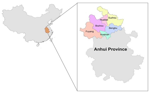
Figure: The location of the Huaibei plain with its six prefectures
The prediction models based on the indicators derived from meteorological, remote sensing variables, as well as the use of chemical fertilizer.
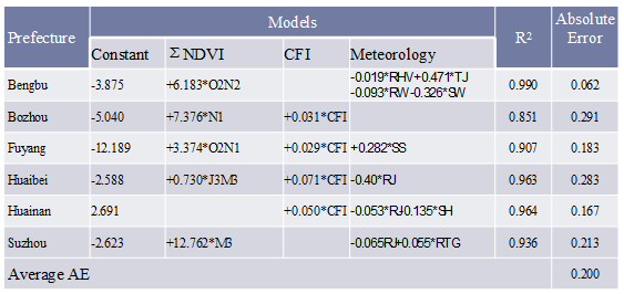
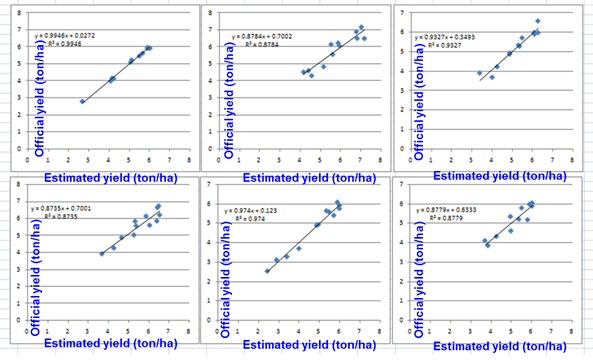
Figure: The location of the Huaibei plain with its six prefectures
Deliverables